
Media Contacts:
Geoffrey Brown, Johns Hopkins Applied Physics Laboratory
(240) 228-5618 or (443) 778-5618
geoffrey.brown@jhuapl.edu
April 19, 2013
Guiding NASA's "Curiosity"
How CRISM Points the Way To Potential Discoveries
For NASA’s Mars Science Laboratory (MSL) and its Curiosity rover to carry out their mission of assessing whether Mars ever had an environment able to support life, it had to land in just the right location, where potential evidence of past water was visible and plentiful. The mission that did the most to help NASA find that location – Gale Crater – was the Mars Reconnaissance Orbiter (MRO). One of the two key imaging instruments on MRO that provided the deciding data was the Compact Reconnaissance Imaging Spectrometer for Mars (CRISM), designed and built for NASA by the Johns Hopkins University Applied Physics Laboratory in Laurel, MD.
Click on image to enlarge.
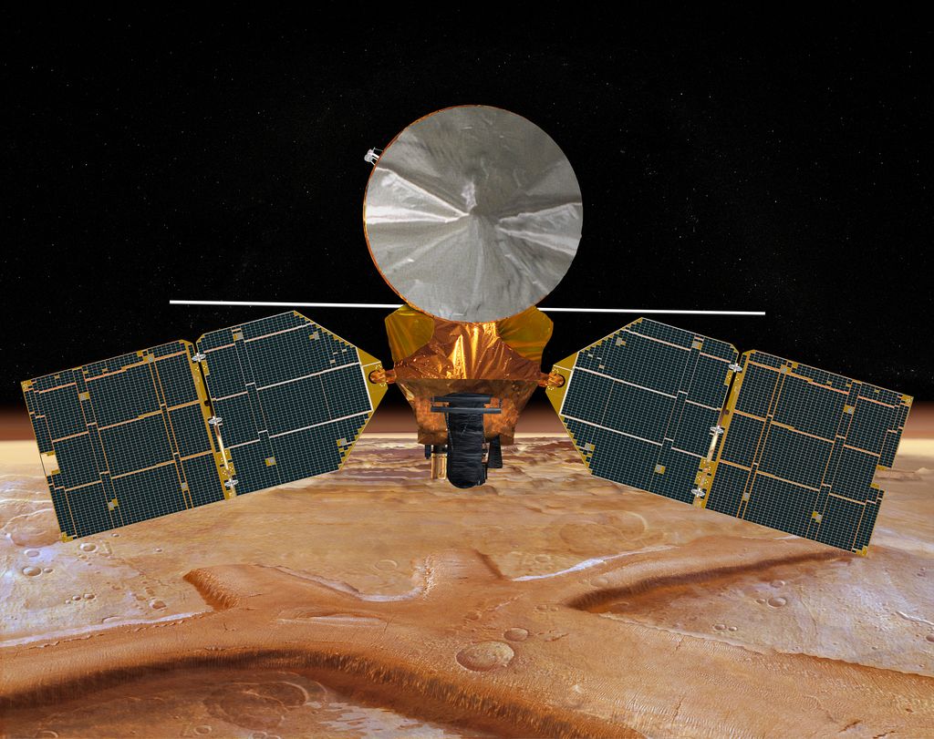
NASA's Mars Reconnaissance Orbiter (MRO), carrying the Compact Reconnaissance Image Spectrometer for Mars (CRISM), blasted off from Cape Canaveral in 2005 on a search for evidence that water persisted on the surface of Mars for a long period of time. MRO entered Mars obit in 2006 and has been providing high-quality science data for more than seven years.
Credit: NASA/JPL-Caltech
CRISM creates detailed maps of the planet’s surface mineralogy using a technique called reflectance spectroscopy, which measures differences in the way minerals reflect sunlight across the electromagnetic spectrum. CRISM identifies minerals on the Martian surface that indicate past volcanism, the past existence of water, and in some cases where rocks have been altered at depth by heated water.
“What we’ve learned is that there are many places where water persisted on the surface of Mars or in the subsurface long enough to leave a chemical fingerprint,” says CRISM Principal Investigator Scott Murchie, discussing the findings of the 20-year-old Mars Exploration Program (MEP). “Water that could have been suitable for living things was most prevalent in the ancient past – before 3.7 billion years ago.” But in Mars’ later history, what limited water remained was so salty and sulfur-rich that it was more like battery acid – more useful as disinfectant than in supporting life. By 2.5 billion years ago, Mars had mostly dried out.
When examining spectral maps, the CRISM team looked for signatures of minerals that indicate where and when water might have suitable for life, or “habitable.” “We searched for the kinds of minerals that would indicate low salinity and neutral Ph,” Murchie says. “The kinds of things that we’re really most interested in are clay minerals and carbonate minerals, like those found in limestone.”
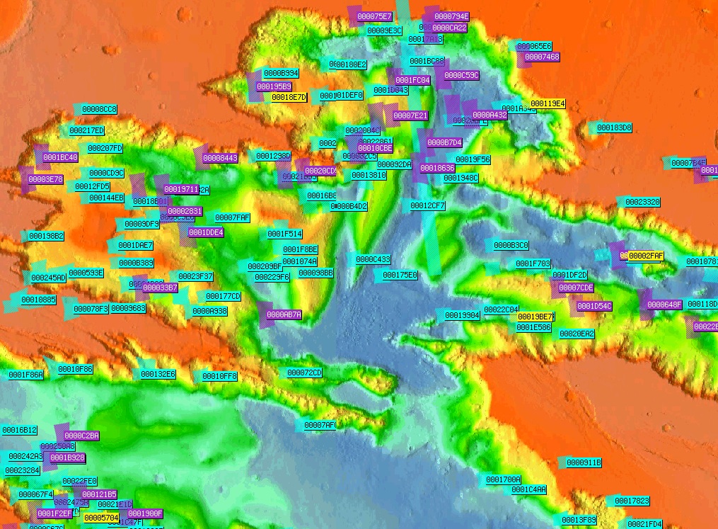
Click on image to enlarge.
A close-up of the interactive map of Mars containing the high-resolution observations made by CRISM to date.
Credit: NASA/JHUAPL
To try to find organic material from past life, the MEP sent the MSL to a place where Curiosity could observe the earlier part of Mars’ history. “You wouldn’t want to land where there are just lava flows or sand dunes because that’s not interesting from the point of view of finding past habitable environments,” Murchie says. “Interesting places that are hazardous are also bad – for example, if there are too many boulders.”
The perfect hybrid of interesting geology and safe access turned out to be a mound of layered rocks at a place unofficially called Mount Sharp (its formal name is Aeolis Mons) in Gale Crater, located just south of the Martian equator. Maps generated by CRISM and MRO’s super-high-resolution camera, the High Resolution Imaging Science Experiment (HiRISE), suggested that in climbing up the mountain, the rover could work its way through Mars’ history, starting with clay sediments in the lowermost layers, move up through sulfate minerals that formed under acidic conditions, and arrive at dust deposits at the top of the mountain from more recent history, after the planet had largely dried out.
“[It’s] like climbing the wall of the Grand Canyon and looking at how Earth changed, except in this case it’s Mars and it’s a continuous record of Martian environmental change,” Murchie says. “That’s why this [landing site] wins.”
The selection of Gale Crater as the MSL landing site unfolded over a series of five workshops that spanned five years. The first workshop to explain MSL’s capabilities to scientists researching Mars and to solicit their ideas on landing sites took place in 2006, before data from CRISM were available. From this first meeting, about 30 sites were proposed.
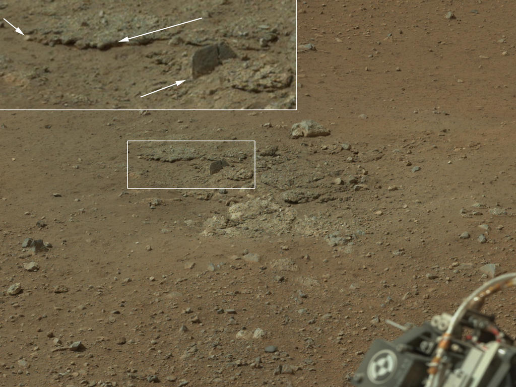
Click on image to enlarge.
This color image from NASA's Curiosity rover shows an area excavated by the blast of the Mars Science Laboratory’s descent stage rocket engines. With the loose debris blasted away by the rockets, details of the underlying materials are clearly seen. Of particular note is a well-defined, topmost layer that contains fragments of rock embedded in a matix of finer material. Shown in the inset in the figure are pebbles up to 1.25 inches (about 3 centimeters) across (upper two arrows) and a larger clast 4 inches (11.5 centimeters) long protruding up by about 2 inches (10 centimeters) from the layer in which it is embedded.
Credit: NASA/JPL-Caltech/MSSS
In the subsequent workshops, the CRISM and HiRISE teams and other scientists from the Mars community presented their data covering each of the proposed sites. By the fourth workshop in 2010, the list had been collectively whittled down to four sites where there was evidence of past water and where there may be a chance of finding preserved organic material.
Of the four sites – Eberswalde Crater, Gale Crater, Holden Crater, and Mawrth Vallis – “three of them probably formed at least in part in standing water, and Ebserwalde and Holden contain what are interpreted to be river deltas,” Murchie says. “They’re nearly 3.8 billion years old, but still likely river deltas. Mawrth was really interesting, but there was no consensus as to what we’re seeing.”
The CRISM team has supported MSL every step of the way, Murchie says. “The community offered many ideas for landing sites, and the MRO data helped pick between good sites and not-so-good sites. When the selections process was narrowed down to only a handful of sites, our teams researched the geology of those sites to help show which stood out above the others.”
About a third of the workshops’ presenters were part of the CRISM team, and they are still supporting Curiosity now that it’s on the surface of Mars. The MSL team has been using CRISM data to make geological maps of the landing site and select where to drive the rover and which outcrops to investigate. When Curiosity landed, the rockets blew the dust off of nearby rocks; the team has measured the spectrum of these areas so that the rover’s direct compositional measurements can test, and hopefully verify, the MRO team’s distant interpretations from orbit.
Murchie says that the CRISM and HiRISE teams’ involvement with MSL was a “strategic decision. We helped as much as we could to shape the future direction of Mars exploration. MRO’s hard work has given it the role as the go-to team to characterize the sites where other Mars missions will land in the future.”
With NASA’s announcement late in 2012 that a new Mars science rover will launch in 2020, MRO’s data will continue to be critical in the selection of landing sites for Martian exploration – and CRISM will remain a valuable source of information about the surface mineralogy of Earth’s most-studied neighbor.
- Lydia Zuraw
The Applied Physics Laboratory, a not-for-profit division of The Johns Hopkins University, meets critical national challenges through the innovative application of science and technology. For more information, visit www.jhuapl.edu.