
Seeing the Surface
Capturing Images
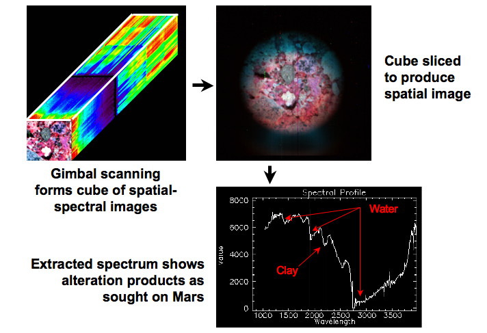
CRISM images can be thought of as “cubes” of data. Each pixel in a two-dimensional CRISM image has a corresponding spectrum of reflected sunlight covering CRISM’s wavelength range, from the visible to the infrared; this spectral data could be thought of as the third dimension of the “cube”. CRISM builds this “cube” by taking images one line at a time. Each pixel along the line has a full spectrum of reflected sunlight. Over two to three minutes, a two-dimensional spatial image of a target is built up by taking successive lines as the spectrometer is swept across the targeted region. This sweeping motion can be performed by either the movement of CRISM's gimbal or by MRO's along-track motion over the Martian surface.
This graphic shows a single CRISM observation sequence of a rock sample obtained during ground testing. The target was a breccia, a kind of sedimentary rock.